Mostrando entradas con la etiqueta Juliana Melo. Mostrar todas las entradas

1 de diciembre de 2010

Santa Fe O.o

Santa Fe is the site number three in the Capital District of Bogota. It forms the traditional city center, sharing with the Candelaria, a town that is located inside its territory, separated in 1991. The Santa Fe town derived its name from the ancient name of the capital. Much of the development of Bogota in the town. Santa Fe area includes the skyscrapers of the Seventh Race and the International Center, the banking sector Avenida Jimenez, among others, as well as the traditional commercial district of San Victorino, Bogota trade hub since colonial times. The village also has a rural part corresponding to the hills of Montserrat and Guadeloupe, with their respective shrines.
Limits
Bank buildings, Santa Fe.
*Norte Location: Canal Street Archbishop or 39, with the town of Chapinero.
*South: First Avenue, with the town of San Cristobal.
*East: Eastern Hills, the municipalities of Choachí and Ubaque (Cundinamarca).
*West: Avenida Caracas, with Teusaquillo, Martyrs and Antonio Nariño
*Interior: Carrera 9, Avenida Jiménez Carrera 1 and Calle 6 with the locality of La Candelaria.
Places of Interest
-Northern
-Santa Fe Area
-The Independence Park
-La Plaza de Toros de Santamaria
-The Park Towers
-The National Museum
-The Independence Park, Third Millennium and the National Olaya Herrera
-The Rebecca
-The Natural History Museum
-The Planetarium
-The Gold Museum
-The National Library of Colombia
-The churches of San Francisco, the    Third, Veracruz, La Peña, and the Capuchin
-Church of the Lord of Monserrate.
-La Plaza de Mercado de las Cruces.
-La Torre Colpatria.
-La Universidad Jorge Tadeo Lozano.
-The neighborhood of La Merced.
-El Colegio San Bartolomé la Merced

Usaquen :D

Usaquén is the number one area of the Capital District of Bogota. It is located north of the city.
The town is divided into nine Usaquén UPZ (Zonal Planning Units).
In turn, these units are divided into districts, as here (some districts share UPZ):
*Paseo de Los Libertadores: Canaima, La Floresta de La Sabana and Torchia.*Verbenal: Altos de Serrezuela, Balcones de Vista Hermosa, North Balmoral, Buenavista, Chaparral, El Codito, El Refugio de San Antonio, El Verbenal, Horizontes, La Estrellita, La Frontera, The Llanurita, Los Consuelos, arrowroot, Maturin, Medellín, Mirador del Norte, Nuevo Horizonte, San Antonio North, Santandersito, Tibabita, Viña del Mar.
*The Uribe: Forest San Antonio, Conjunto Camino del Palmar, El Pite, The Fold, La Cita, North La Granja, La Uribe, Los Naranjos, San Juan Bosco, Urbanización Los Laureles.
*San Cristobal Norte: Ainsuca, Altablanca, Canyon, California, North Hill, Danube, Don Bosco, La Perla Oriental, Las Areneras, Milan (Canyon), North Prairie, North San Cristobal, San Cristobal Norte upper, lower San Cristobal Norte
, Santa Teresa, Soratama, Torcoroma, Villa Nydia, Villa Oliva.

*Toberín: The Toberín, Babylon, Darandelos, North Star, Guanoa, North Garden, La Liberia, the North Meadow, The Orchids, Pantanito, Santa Monica, Villa Magdala, Villas de Aranjuez, Mediterranean Villas, Zaragoza.*Cedars: Acacias, Antigua, Belmira, Forest Pines, Caobos Salazar, Capri, Cedritos, Cedro Bolivar, Cedar Golf, Madeira Cedro, Cedro Narváez, Cedar Salazar, El Contador, El Rincon de Las Margaritas, La Sonora, Las Margaritas, Lisbon, The Cedars, The Cedars East Montearroyo, New Highway, New Country, Sierras del Moral.

*Usaquén: Bella Switzerland, Bellavista, Forest Medina, El Pañuelito, El Pedregal, I Escuelle Cavalry, Infantry School, Francisco Miranda, Geneva, La Esperanza, La Glorieta, Las Delicias del Carmen, Sacred Heart, San Gabriel, Santa Ana, West Santa Ana, Santa Barbara High, Santa Barbara Eastern Unicerros, Usaquén.* Country Club: Country Club, La Calleja, La Carolina, crystallinity, Country Meadows, Bend Country, Santa Coloma, Soatama, Toledo, Torres del Country, the Country Vergel.*Santa Barbara: Santa Barbara West, Campo Alegre, North Mills, Multicentre, Navarra, Rincon del Chico, San Patricio, Santa Barbara, Santa Barbara Central, Santa Bibiana, Santa Paula.
LimitsNorth: Road 240 to the town of Chia (Cundinamarca).South Street 100, with the town of Chapinero.East: Eastern Hills with the municipality of La Calera (Cundinamarca).West: Highway North to the locality of Suba.

19 de noviembre de 2010

Salitre :)!!

Ciudad Salitre is one of the most famous of Bogota, distributed in the towns of Fontibón (Ciudad Salitre West) and Teusaquillo (Ciudad Salitre Oriental).
It is a completely urban area with various recreational and business and residential development.
Green spaces are available on the Parque Metropolitano Simón Bolívar and some streets like El Dorado.
Access: Ciudad Salitre is characterized as a city that has wide streets, sidewalks and linear parks, and a multitude of public transportation routes that pass as the Golden Avenue (where you spend the TransMilenio phase III), Avenida of Hope, Avenida Carrera 68, Carrera 50 Avenida Boyacá. They are also available Bogotá Transportation Terminal, which promotes intercity travel service for the Republic of Colombia.
Parkland and recreation: Among the attractions it offers, highlights the multifunctional stadium built along the streets, parks and greenbelts. Among the parks and sports facilities include:*Simón Bolívar Metropolitan Park.*Unidad Deportiva El Salitre*Salitre Magico Park.*Cici Aquapark*Sauzalito Park

museum of science and technology !!

11 de noviembre de 2010

Chapinero !!

Chapinero is the location number two in the Capital District of Bogota. It is located northeast of the city.
The area called Chapinero traditionally includes the town of Chapinero and part of Teusaquillo and Barrios Unidos, since it is the only place in Bogotá whose territory beyond its perimeter (a kind of suburban area), as is the case of Western Chapinero Teusaquillo and Chapinero Los Alcazares in the Barrios Unidos. Commonly the territories of Chico, El Lago, Catalonia and the rest of the town to the north and the eastern hills of the town are not included on this traditional name, as a matter of cultural influence.

The total area of the town is 3,898 hectares and the urban area is 1,349 hectares. This makes the town is located in the twelfth position in the urban area of the city.
*North Street 100, with the town of Usaquén.*South: Avenida 39, with the town of Santa Fe*West: Highway north and Avenida Caracas with the locality of Barrios Unidos and Teusaquillo.*East: Eastern Hills with the municipality of La Calera (Cundinamarca).

 
Chapinero is one of the most important of Bogota and is composed of three major urban areas: the area of Chapinero, Lake and Chico. All residential areas have become important industries. It is considered the most urban area, but its large sector of the surrounding hills to the east, the town complementary as mixed.
The rural area is crossed by the eastern hills are heavily wooded with streams and rivers that originate in the top and lost to reach the city between canals and drains.
The most important rivers are the Archbishop, which flows into San Francisco before it flows into the Rio Bogota, and the Viceroy, which is part of the El Salitre, Bogotá River flows into the river as the Juan Amarillo.
Although throughout most of history was separated geographically from the city, Chapinero is with Santa Fe, La Candelaria and Teusaquillo, more traditional locations of the city, and beside the two latter forms a set of traditional neighborhoods that are distinguished by portraying a time in the city. Chapinero, once a high class neighborhood, was built with big houses exposed brick facades and architectural style (Victorian) reflecting the strong influence of English in the early twentieth century.

La Candelaria :) !!

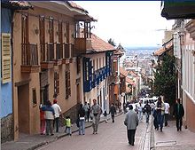
La Candelaria is the location number 17 of the Capital District of Bogota, capital of Colombia. Located in the center east of the city of Bogotá.


La Candelaria is located within the city of Santafe. Its boundaries are determined:
*From the North: The environmental axis (San Francisco River).
*To the south, Fourth Street.
*For the West: the tenth race.
*To the east: Circunvalar Avenue, up the Carrera 4 east and further north around the neighborhood includes Egypt and down again to connect to the Avenida Jimenez in the cable car and funicular.
The town of La Candelaria in Bogota is the historical and cultural heart of the city. Since its inception in the business of the city was moving down the hill and to the north, colonial architecture was maintained intact. The historic center of Bogotá is one of the best preserved in Latin America. It has attracted artists, foreign writers and intellectuals in general, they have filled the area theaters, libraries and universities, in keeping with the cultural reputation of Colombia in the Spanish speaking world. Visitors can see there the colonial houses with latticed windows, carved doors, red tile roofs and eaves. The Mayor of Bogota carries out plans for renovation and preservation of property and cobbled streets, a local feature.


22 de octubre de 2010

The Militar Museum :)

In the Militar Museum you can see many things, but you dont have to pay anything for it.


In the militar museum is located in the calendaria of bogota, if you go there is a gide person that can tell you about for it, also you can see many thing like the maps they have there is very interesant to go and learn about it, the first time that we go mi family dont know ans see and enter ans is very interesant. 


Also we can watch the worn that the military use depending on the time they are, also you can see many history but you cant take any photo except one that we can take it thta is the one of the boat you can see down of the information that boat is built many years ago.


Also you can see the helicopters and the airplanes that they use, you can see at down you can see one of the helicoptres they use on that time any body cant enter in so for that reason you can see the red band, and the Airplanes they use it to bomb or firing with the countries they are in war.


And on my left side you can see the weapons they use to kill the persons t¡in that time but that weapons wost of the time are guns with many power.

27 de agosto de 2010

The Gold Museum!!!

To enter to the Gold Museum you have to pay the entrance that is 3,000  pesos (but children under 12 do not have to pay and the senior age also dont have to pay).
In the gold museum you can see many things but the most important is "la balsa de la cultura muisca " is a very representative material of the Gold Museum, you also have to take into acconut another important thing that is the Gold Museum mummy, that is the mummy of the MUM GUANE.
Visiting a museum is a deli activity that unified the family,were do you have pleasure. Parents may invite their sons and daughters and grandparents to their grandchildren, to visit the Gold Museum Exhibition. This will be a bird or fish? is a figure to weird becaus we don't know what is. 
Why Indians represented many jaguars? because, they see that the jaguars are in the trees and in the cabes so they think that they are in the sky and in the world so they are like Gods. 

Sheikh, a shaman muisca in the time of the Conquest-making strong boys and researchers of the wonderful objects of archaeological collections in the Gold Museum, so after that experience the family will enjoy as never going together to visit the Gold Museum.The functions that are realized are:

Tuesday to Friday10:30 and 11:30 a.m. and 3:30 and 4:30 p.m.
  
Saturday 10:00 a.m., 11:00 a.m., 11:30 a.m. and 2:00 p.m., 3:30 p.m. and 4:30 p.m.
     
Sunday All day from 10:00 a.m.